River Torrens, Torrens Lake, Weirs, South Australia


(Photo (©) - Peg & Bill Chartres' collection - 2016)
The River Torrens was named after Colonel Robert Torrens by Colonel William Light .
It is also know by its native Kaurna name,
Karrawirra Parri
(Karra meaning redgum, Wirra meaning forest and Parri meaning river).
It is the main river on the Adelaide Plains, and flows from near Mount Pleasant, in the Mount
Lofty Ranges, to a man made outlet to the sea at Henley Beach.
The river is also known as Tarnda Parri (Tarnda "Red kangaroo" Parri "river")

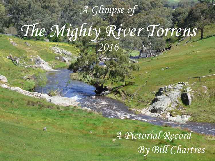
A Glimpse of The Mighty River Torrens 2016
Normally little more than a string of water holes (other than
immediately above the five weirs/dam) the River Torrens can quickly become flooded in
times of heavy rainfall.
In September and October 2016 we experienced one of those occasions, with 348 mm of rain
(recorded at our home in Lobethal), causing wide spread flooding.
During breaks in the storms we took many photos and videos of the river, which form the basis
for this page.
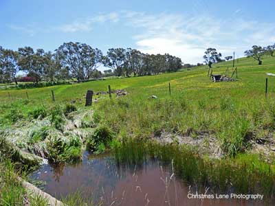
My wife, Peg, and I followed the flooded River Torrens in October 2016 looking for its source.
We knew that it began between Mount Pleasant and Springton, but were unsure exactly where.
By following the now well-defined water course we were able to see that it begins at a spring
in a paddock off Burns Road, Mount Pleasant (opposite the Mt Pleasant
Golf Course), approximately 480 metres above sea level, from here the river flows
approximately 85 km to the sea at West Beach.
From its humble beginning at the spring it flows under Burns Road, across another paddock,
under Eden Valley Road then it creates a water course in its own right. It continues through
the undulating countryside of the townships of Mount Pleasant, Birdwood, Gumeracha and Cudlee
Creek where it enters the Torrens Gorge, and continues past Castambul until the end of the
Gorge at Athelstone.
From Athelstone it flows through the Adelaide Plains, and the CBD continuing until it reaches
the sea at West Beach. During its journey to the sea the River Torrens passes over five weirs,
is fed by numerous tributaries and feeds three of Adelaide's reservoirs
(Kangaroo Creek, Millbrook and Hope Valley).
During periods of heavy rainfall it may cause serious flooding and other damage.
All photographs by Bill Chartres were taken during September & October 2016
The River Torrens Outlet at West Beach was man-made.
The River Torrens Outlet was constructed to control the frequent flooding of the roads and the
railway to the townships of Grange and Henley Beach as well as many Market Gardens in the area.
However the loss of the filtering effect of the reed beds meant that storm water, contaminated
with sediment, sewerage and fertilisers, flowed into the ocean causing a significant
loss of inshore seagrass which impacted on marine habitats and caused sand movement.
Prior to its construction (which took several years and was completed in
1937),
the river flowed into a series of freshwater wetlands which spread behind the sand dunes from
Glenelg to Semaphore.
These wetlands were known as “The Reedbeds” (the name being because
of the reeds growing in the area) and they provided filtered water and habitat
to many native animals and plants.
The River Torrens only ever reached the sea through the Patawalonga and Port Rivers when flooded
during periods of extremely heavy rainfall.
Since 2000 efforts have been made to improve the water quality of the River Torrens and its
local coastal environments.
These projects which include in-river wetlands, fish and eel ladders, sediment and pollution
removal traps along with water
quality monitoring are being implemented by government,
non-government and school groups.
The general public can help protect the river ecosystem and marine environment by:-
• Disposing of waste responsibly.
• Avoiding the use of fertilisers and sprays, especially in the vicinity of waterways.
• Planting native vegetation in their backyards.
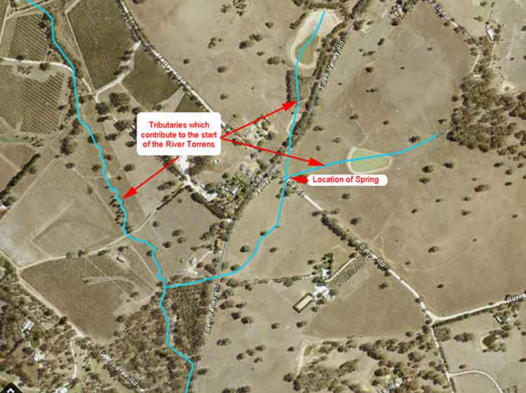
An aerial view of the start of the River Torrens
The blue lines show water courses
The location of the spring, and the tributaries of the
River Torrens are shown in red.
Photos of the River Torrens
The Upper Reaches
Mount Pleasant to Gumeracha
The Upper Reaches of the River Torrens run through undulating, picturesque farmland and the townships of Mount Pleasant, Birdwood, Gumeracha and Cudlee Creek in the Adelaide Hills
The River Torrens,
Golf Links Road, Mount Pleasant, SA.
(Photo Peg & Bill Chartres' collection - Circa 2016)
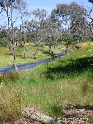
The River Torrens,
Talunga Park Road, Mount Pleasant, SA.
(Photo Peg & Bill Chartres' collection - Circa 2016)
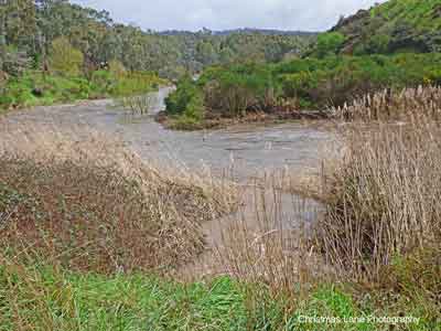
The River Torrens,
Cromer Road, Mount Pleasant, SA.
(Photo Peg & Bill Chartres' collection - Circa 2016)
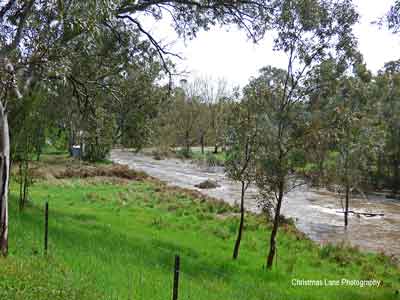
The River Torrens,
Black Snake Road, Birdwood, SA.
(Photo Peg & Bill Chartres' collection - Circa 2016)
The River Torrens,
Cromer Road, Mount Pleasant, SA..
(Photo Peg & Bill Chartres' collection - Circa 2016)
The River Torrens,
Black Snake Road, Birdwood, SA.
(Photo Peg & Bill Chartres' collection - Circa 2016)
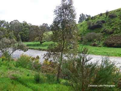
The River Torrens,
Torrens Valley Road, Gumeracha, SA.
(Photo Peg & Bill Chartres' collection - Circa 2016)
The River Torrens,
Torrens Valley Road, Gumeracha, SA.
(Photo Peg & Bill Chartres' collection - Circa 2016)
The River Torrens,
Torrens Valley Road, Gumeracha, SA.
(Photo Peg & Bill Chartres' collection - Circa 2016)
Photos of the River Torrens
The Middle Reaches
The Gumeracha Weir to The Gorge Weir
The construction of the Gumeracha Weir (capacity 200 ML)) was completed in 1918 to divert water from the River Torrens to the newly constructed Millbrook Reservoir.The construction of the Kangaroo Creek Dam (capacity 19,160 ML) was completed in 1969. Water from Kangaroo Creek Dam is released into the River Torrens as required, to maintain the level in the Hope Valley Reservoir. The water is diverted to Hope Valley at the Gorge Weir.
In 2015 an upgrade of the Kangaroo Creek Dam was begun, the dam wall was raised by 4 metres and the Spillway widened by 40 metres (This upgrade will not increase the capacity (19,000 ML) as the hight of the spillway remains unchanged) , the upgrade was completed in 2019.
These upgrades will help manage major floods, and they will also increase the dam's ability to withstand earthquakes.
The construction of the Gorge Weir (capacity 24 ML)) was completed in 1859. In 1872 it was connected to the Hope Valley Reservoir via the Aqueduct.
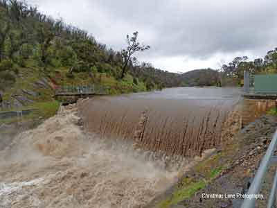
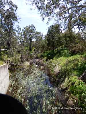
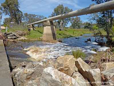
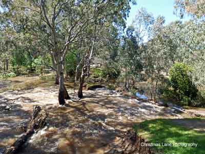
The Gumeracha Weir,
on the River Torrens.
(Photo Peg & Bill Chartres' collection - Circa 2016)
The Gumeracha Weir discharge,
on the River Torrens.
(Photo Peg & Bill Chartres' collection - Circa 2016)
The Gumeracha Weir,
on the River Torrens.
(Photo Peg & Bill Chartres' collection - Circa 2016)

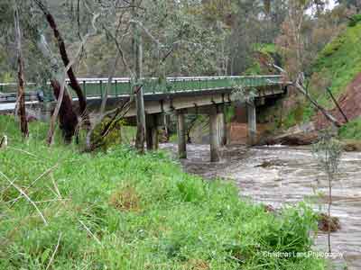
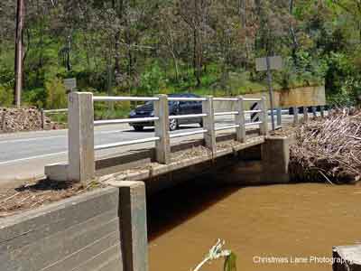
The Gumeracha Bridge, below the Gumeracha
Weir Torrens Valley Road, Gumeracha, SA.
(Photo Peg & Bill Chartres' collection - Circa 2016)
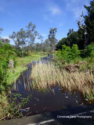
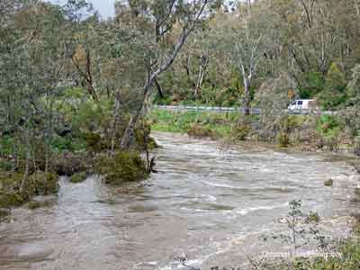
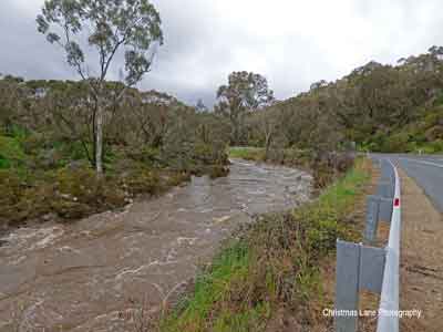
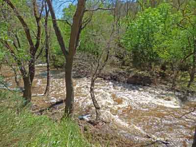
The River Torrens,
Gorge Rd., near Tippet Rd.
(Photo Peg & Bill Chartres' collection - Circa 2016)
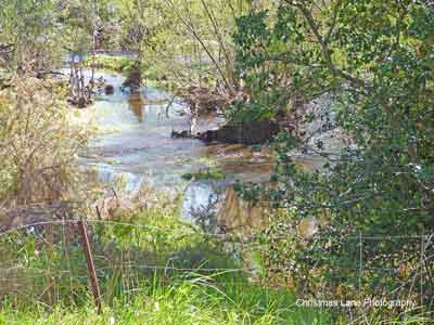
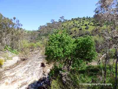
Hollands Creek flowing into the River Torrens,
Banks Rd., Cudlee Creek, SA.
(Photo Peg & Bill Chartres' collection - Circa 2016)
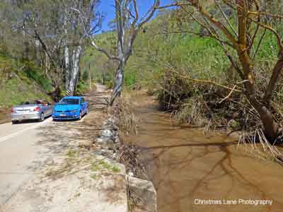
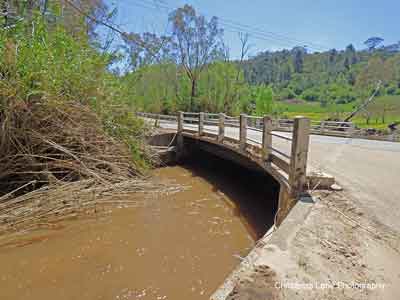
The River Torrens,
Banks Road, Cudlee Creek, SA.
(Photo Peg & Bill Chartres' collection - Circa 2016)
The River Torrens,
Banks Road, Cudlee Creek, SA.
(Photo Peg & Bill Chartres' collection - Circa 2016)
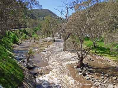
The River Torrens,
Gorge Rd. below Prairie Rd.
(Photo Peg & Bill Chartres' collection - Circa 2016)
The River Torrens,
Gorge Rd. below Prairie Rd.
(Photo Peg & Bill Chartres' collection - Circa 2016
The River Torrens,
New Prairie Bridge, Gorge Rd., Cudlee Creek, SA.
(Photo Peg & Bill Chartres' collection - Circa 2016)
The River Torrens,
Gorge Rd. below Prairie Rd.
(Photo Peg & Bill Chartres' collection - Circa 2016)
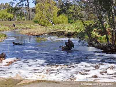
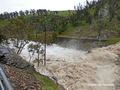
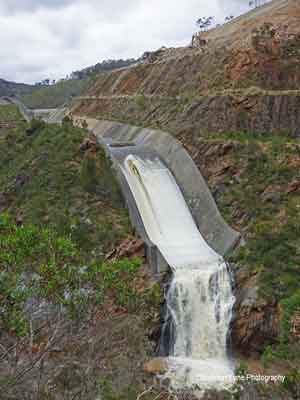
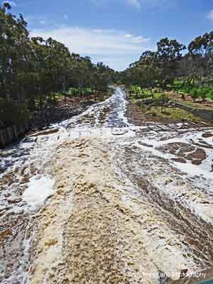
The Kangaroo Creek Weir Spillway discharge,
Gorge Road, Cudlee Creek, SA.
(Photo Peg & Bill Chartres' collection - Circa 2016)
The Kangaroo Creek Weir Spillway, River
Torrens, Gorge Rd., Cudlee Creek, SA.
(Photo Peg & Bill Chartres' collection - Circa 2016)
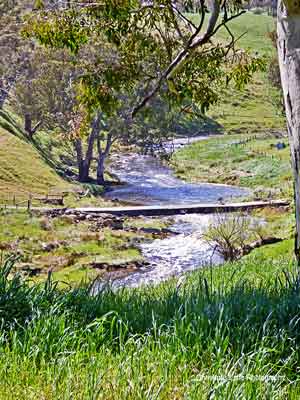
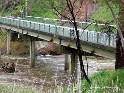
The River Torrens,
above the Playford Bridge, Castambul, SA.
(Photo Peg & Bill Chartres' collection - Circa 2016)
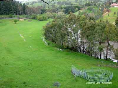
The River Torrens,
below the Playford Bridge, Castambul, SA.
(Photo Peg & Bill Chartres' collection - Circa 2016)
Sixth Creek, above the River Torrens Junction
with Corkscrew Road,
Castambul, SA.
(Photo Peg & Bill Chartres' collection - Circa 2016)
Sixth Creek, flowing into the River Torrens
under the Sixth Creek Bridge, Gorge Rd.
Castambul, SA.
(Photo Peg & Bill Chartres' collection - Circa 2016)
Sixth Creek, flowing into the River Torrens
under the Sixth Creek Bridge, Gorge Rd.
Castambul, SA.
(Photo Peg & Bill Chartres' collection - Circa 2016)
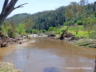
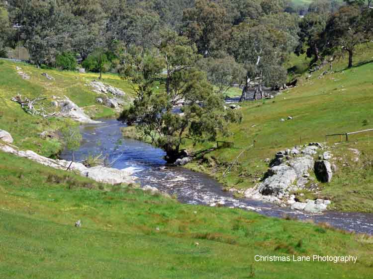
The River Torrens, below the Sixth Creek junction,
Gorge Rd., Castambul, SA.
(Photo Peg & Bill Chartres' collection - Circa 2016)
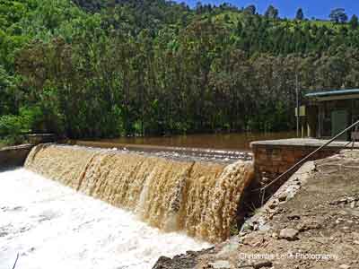
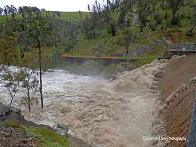
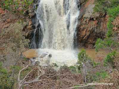
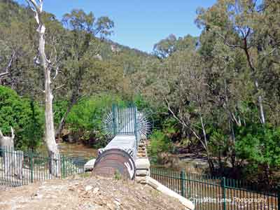
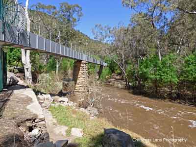
The Gorge Weir, River Torrens, Gorge Rd.,
Athelstone, SA.
(Photo Peg & Bill Chartres' collection - Circa 2016)
River Torrens, flowing under the Gorge Weir
Aqueduct, Gorge Rd. Athelstone, SA.
(Photo Peg & Bill Chartres' collection - Circa 2016)
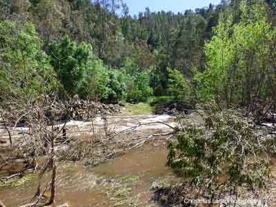
The River Torrens, Gorge Rd., below Castambul, SA.
(Photo Peg & Bill Chartres' collection - Circa 2016)
River Torrens, flowing under the Gorge Weir
Aqueduct, Gorge Rd.,
Athelstone, SA.
(Photo Peg & Bill Chartres' collection - Circa 2016)
N.B. The following link takes you to the You Tube site.
to view a video clip filmed 3rd October 2016
Click back on your browser to return to this page, Bill
Photos of the River Torrens
The Lower Reaches
The Gorge Weir to The Torrens Outlet
The two weirs below the Gorge weir are not used to supplement Adelaide’s water supply.
Torrens Lake (capacity 470 ML)
The appearance of the river in the city was a contentious issue in the early years of the settlement of Adelaide.
In 1862, prison labour from Adelaide Gaol was used to build a wooden dam near the site of the current weir.
On 25 June 1867 the Register reported:
"Although the Torrens dam has not been swept away ... boating on the silvery bosom of the river is as effectivilly (sic) stopped as if it had."
In fact the lake had been drained to allow for the laying of the foundations for the Morphett Street (Victoria) bridge which was opened for traffic in June 1870.
Earlier Thomas Worsnop, the Town Clerk, had written:
"The so-called River Torrens is nothing more than a mountain torrent in the wet season, and in summer a petty stream, which in England would scarcely be termed a brook. The winter ravages destroy the high banks, from the rush of waters gathered by the mountain range which lies to the east of Adelaide. They are at all times unsightly, and nothing that had been done (or, indeed has been done up to the present time) had made any great change in their appearance."
The dam was poorly constructed and was washed away by floods in 1872 resulting in the call for a more substantial and effective dam to be constructed. Despite popular demand, the city council did not complete a new stone weir until 1881.
The concrete weir construction and landscaping of the lakes surround, was begun in November 1880 and completed, (at a cost of £7,000 ($14,000) ,on 1st July 1881, when the sluice gates were closed to begin filling the 30-acre (12-hectare) Torrens Lake.
At the lake's official opening on 21st July 1881 an estimated 40,000 people (almost the entire population of Adelaide), attended. During a flood in 1889, the weir's gates jammed, and whilst trying to free them the weir's designer John Langdon was crippled.
The weir was rebuilt between 1928 and 1929 with its footbridge relocated and the centre section replaced, enabling the gates to be fully raised to allow the river to flow unimpeded.
Today the Torrens Lake and Elder Park, with its 9 metre high Iron Rotunda (opened on 28 November 1882, funded by Sir Thomas Elder Smith, after whom the park was named) forms a centrepiece for many of Adelaide's events.
The Torrens Outlet Weir
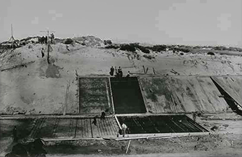
The Torrens Outlet Weir (at West Beach) was completed by 1937 with the creation of the "Breakout Creek" channel, to divert the River Torrens water away from the Reedbeds to the ocean. The Weir prevents the ocean from entering the River Torrens system during high tides and a fish ladder has been installed to give fish access from the sea to the fresh water system.
Photo left credit slsa B1865_5 c.1937 Construction of the sea outlet for the River Torrens
River Torrens Linear Trail
The River Torrens Linear Trail, featuring level, bitumen paths, runs from Paradise, just south the Torrens Gorge to the Torrens Outlet at West Beach (with a Walkway/Bikeway on the northern side of the River Torrens the entire way, and on the southern side for most of the way) , bridges are located along the trail so users can make a loop and return to their starting point, and there are many open areas to stop for a picnic or just feed the ducks. Access is available at many points and it is popular with families for leisure time, as well walkers and cyclists. The section from the Adelaide Zoo past the Adelaide Convention Centre and Adelaide Festival Centre is popular providing relief from the hectic life in the City.
The River Torrens Park provides much native vegetation and trees as habitat for birds and other fauna, with the River Torrens providing food and water.
The River Torrens,
River Torrens Linear Trail, Paradise, SA.
(Photo Peg & Bill Chartres' collection - Circa 2016)
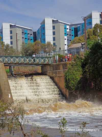
River Torrens,
the discharge from the Lake Torrens Weir.
(Photo Peg & Bill Chartres' collection - Circa 2016)
The River Torrens,
River Torrens Linear Trail, Paradise, SA.
(Photo Peg & Bill Chartres' collection - Circa 2016)
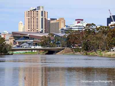
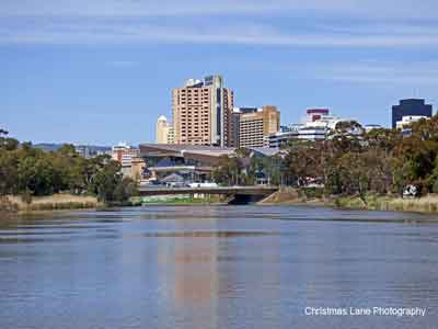
Torrens Lake,
with Adelaide CBD in the background.
(Photo Peg & Bill Chartres' collection - Circa 2016)
Torrens Lake,
with Adelaide CBD in the background.
(Photo Peg & Bill Chartres' collection - Circa 2016)>
Torrens Lake,
with Adelaide CBD in the background.
<(Photo Peg & Bill Chartres' collection - Circa 2016)>
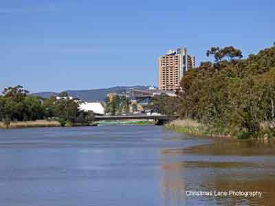
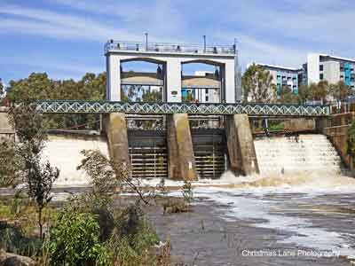
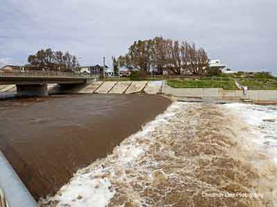
River Torrens,
with Torrens Lake Weir in the background.
(Photo Peg & Bill Chartres' collection - Circa 2016)
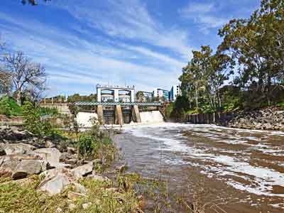
Torrens Weir Spillway.
(Photo Peg & Bill Chartres' collection - Circa 2016)
Torrens Weir,
flowing into the River Torrens.
(Photo Peg & Bill Chartres' collection - Circa 2016)< /span>
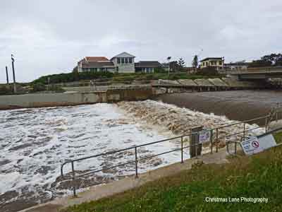
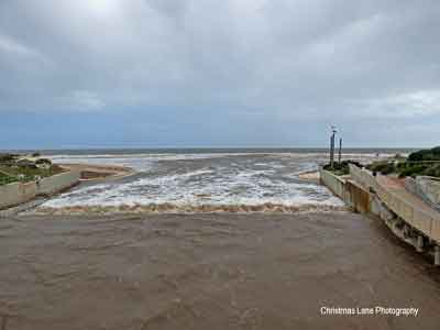
River Torrens Outlet,
looking north.
(Photo Peg & Bill Chartres' collection - Circa 2016)
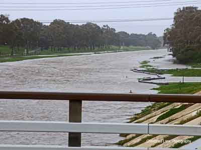
River Torrens, "Breakout Channel",
looking east from the road bridge.
(Photo Peg & Bill Chartres' collection - Circa 2016)
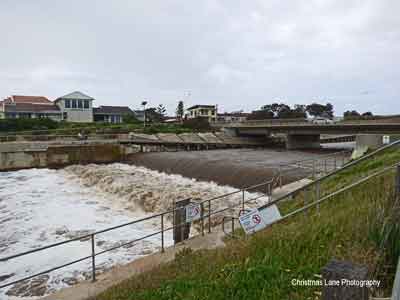
River Torrens Outlet,
looking north.
(Photo Peg & Bill Chartres' collection - Circa 2016)
<
River Torrens Outlet,
flowing into the ocean.
(Photo Peg & Bill Chartres' collection - Circa 2016)
River Torrens Outlet,
flowing into the ocean.
(Photo Peg & Bill Chartres' collection - Circa 2016)
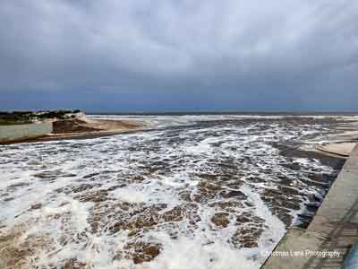
River Torrens Outlet,
looking south.
(Photo Peg & Bill Chartres' collection - Circa 2016)
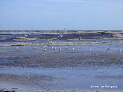
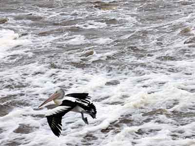
Birds enjoy the River Torrens
water discharge into the ocean.
(Photo Peg & Bill Chartres' collection - Circa 2016)
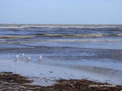
Birds enjoy the River Torrens
water discharge into the ocean.
(Photo Peg & Bill Chartres' collection - Circa 2016)
Birds enjoy the River Torrens
water discharge into the ocean.
(Photo Peg & Bill Chartres' collection - Circa 2016)